SLAM-Based Forest Plot Mapping by Integrating IMU and Self-Calibrated Dual 3-D Laser Scanners
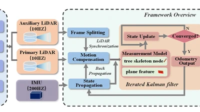
This paper proposes a dual-scanner backpack LiDAR system with automatic self-calibration and a tightly-coupled SLAM framework integrating IMU and forest natural features, achieving …
dong-pan